A POC application for a drone delivery startup
Itransition developed a POC Android mobile app for a drone delivery startup to help them prove their project’s feasibility.
Table of contents
Context
The customer is a startup providing drone solutions to help their clients establish, maintain, and support automated operations. They aimed to disrupt the shipping industry with a drone product delivery ecosystem of services and apps integrated with retailer shopping carts.
The customer wanted to start with creating a POC Android app that would determine user location with high accuracy and facilitate drone delivery. The POC had to be delivered within a six-week deadline and it was necessary to test the initial idea’s feasibility and file the legal paperwork for IP protection.
The company’s CEO, a drone expert with a solid technical background, asked Itransition to develop a POC Android app. They chose us due to our expertise in mobile app development, established R&D practices, and a track record as developers of complex custom solutions.
Solution
Itransition’s team was in charge of selecting technologies, analyzing customer requirements, developing a POC Android app, and creating an extended product documentation package.
The project began with our business analysts and tech team collaborating with the customer to determine the scope of the POC solution. Together we decided on a prototype that would help us test landing zone accuracy and, if we were successful, move on to the next stage, namely connecting the app to drones.
The prototype application was supposed to allow users to create a landing zone using their location data or photos of the area, store the landing zone data, and transmit GPS coordinates to the drone software. The app would also have two user roles: customers and drone operators.
We enabled the app-drone connection in the following way: a drone operator opens the database with landing zones, copies the landing zone GPS coordinates, and manually creates the waypoint via the drone software, checking user landscape photos for obstructions.
To ensure high accuracy in determining the touchdown zone, our developers added the necessary parameters to the application’s code. The accuracy of user geo-positioning also depends on a user’s mobile network provider as well as the device’s hardware, Wi-Fi and geolocation features. This is why we included location parameters set up by the provider, using the fused location provider, and set up maximum accuracy in the OS settings.
The customer tested the POC app under different conditions, including ones that would impair the accuracy of user geo-positioning, and our solution performed well under all tests. This way, we helped prove the idea behind the project by achieving the required level of accuracy.
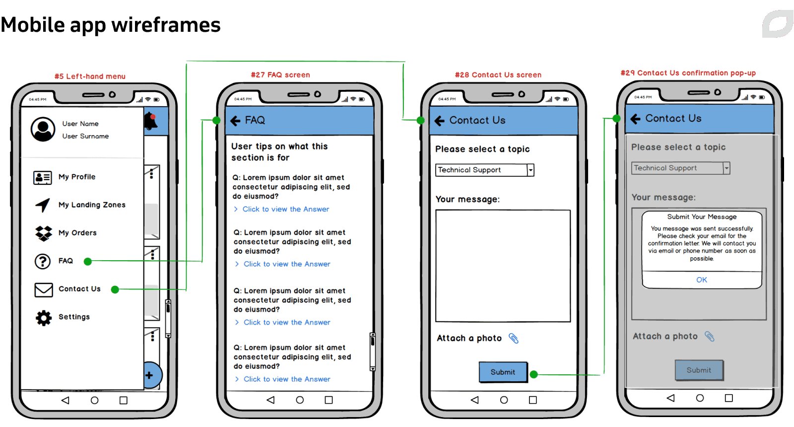
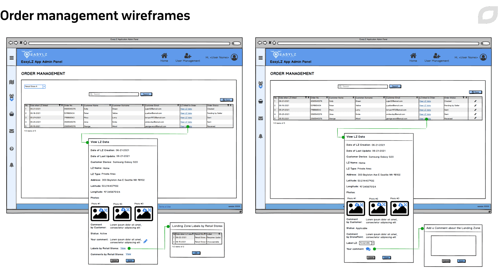
As part of the discovery phase, we created comprehensive documentation that includes development and design estimates, wireframes for the mobile app and admin panels, and a work breakdown structure (WBS) for the admin panel.


Technologies
The customer chose to build an Android app to get access to a wider market and ensure seamless communication with Android-based drones.
Our development team opted for native Android technology Kotlin due to its built-in security features, increased flexibility, clean language design, and powerful features well-suited for large-scale projects. We also used the Retrofit library to implement the network layer since it is recommended by Google as a best practice.
For data protection, we chose SQLite, which offers automatic encryption. We also selected Microsoft ASP.NET Core Web API as a popular multipurpose platform, Docker support with Azure Container Registry as image storage, and a Linux-based Azure Application Service for containers as a hosting environment.
For further development of the drone delivery solution, we advised the customer to use the View Class Component library for UI design, Firebase Cloud Messaging for push notifications, and CameraX, a Jetpack support library, for camera capabilities.
For determining user location, our team proposed using the native Location Provider tool that can utilize all possible resources to accurately detect user location, including GPS, Wi-Fi, and native network layout.
What is more, to help the customer enhance app security, Itransition developers described the main types of potential attacks and created a list of basic recommendations for preventing them.
Results
Itransition team delivered a POC drone delivery application to the customer two weeks ahead of the initial estimate. The customer uses the POC app to present their idea to investors and retail store representatives. The app’s future use areas include contactless delivery, real-time 3D mapping, endangered species and crop monitoring, aerial investigations, and more.

Services
Mobile application development services
Entrust your mobile application development, modernization, and support to Itransition, a reliable vendor with 15+ years of experience in mobile services.

Services
Retail software development services, solutions & tech stack
Learn how our retail software development company helps retailers and ecommerce businesses deliver great customer experiences through reliable software.

Case study
Job search app testing and web development for a US university
Read this case study about Itransition’s project for a US university research center to deliver job search app testing and two custom web portals.

Case study
An AR app for interacting with celebrities
Learn how Itransition helped to develop an AR app for interacting with celebrities for iOS and Android.

Case study
A remote patient monitoring and mobile telehealth suite
Learn how Itransition developed a remote patient monitoring and telehealth platform for sexual assault victims for a US research center.